Tuesday, December 01, 2020

Kings Canyon/Sequoia: November 2020

We needed a camping trip – – but a combination of smoky skies and the pandemic had kept us locked up at home.  As soon as the smoke abated, we decided to take a short risk-averse trip to a "comfort food" location, both familiar and close to home:  the Sequoias.

Nov. 16:  The drive to Azalea Campground took us about 6 1/2 hours, and we were able to snag a nice unreserved campsite that was somewhat isolated from the rest of the campground.  (All of the usual Western Sierra boondocking areas in the national forest were behind gates that had been locked for the winter, so we had to stay in a campground.)  It had snowed a little bit a few days before we arrived:


After getting the campsite set up, we took a pleasant walk around Grant Grove in the late afternoon.  Check out the unusual shadowing on the trunk of the General Grant tree -- the light of the setting sun was virtually horizontal:


(By the way, Felice took that picture with her iPhone!)

The very last rays of the sun caught the top of this giant – – the distinctive "broccoli" structure of the crown is clearly visible:


Nov. 17:  Since it was a cold, cloudy day (excellent hiking weather), we took a "forest" hike to Muir Grove, rather than a "view" hike.  We saw one other person on the trail that day, and we had the entire grove to ourselves for more than two hours.  Felice greeted the Sentinel Tree at the entrance to the grove.  (It doesn't actually have a name, but it should.)


There is no way to capture the entire Circle of Giants, but this shot comes close.  (And no, that is not an official name, either.)


Felice noticed that this "goose pen" (an open area at the base of the tree) looked like a heart:


(And those were called "goose pens" because the early settlers supposedly kept geese in there.)

We then trekked off-trail to visit the Husband & Wife Trees (no, not an official name), as we almost always do.  (Felice named those trees because they share a foundation but stand on their own as individuals.)


This is as close to climbing as I get -- which is not very close:


Nov. 18:  Rain!  Not much, but still very welcome.  As is often the case, a cold dark rainy night meant that we slept very late -- till 8 am!  (Full disclosure -- we slept later than we usually do all week.  The temperature inside the trailer at night was in the low 40s:  perfect!  Better yet, the outside temp never fell below freezing, so we didn't have to worry about the water lines.)

After our usual leisurely breakfast, we were off to Redwood Canyon, with our ponchos draped over our backpacks:


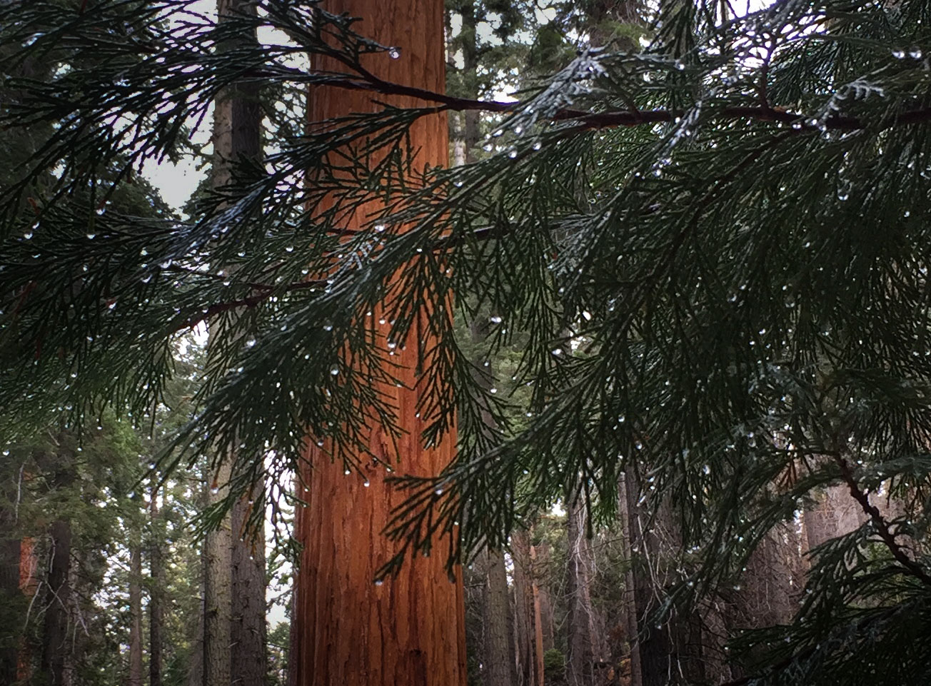
The needles of the Sequoia seedlings were tipped with raindrops -- Felice took this with her iPhone:


Although we've been to this canyon many times, we had never before heard the tremendous crash of huge limbs falling from hundreds of feet in the air.  This time, during a few hours in the canyon, we heard four separate limb-drops, not too far away from us.  

It sounded something like thunder:  a sudden sharp crack, followed by a series of rolling impacts as the thick falling branches slammed down and down through the forest canopy, breaking off the branches below, culminating with an earthshaking thud and a final sprinkle of leaves and bark.  Each event lasted several seconds.  Terrifying, but really cool.

It could be that the sound carried so well on this wet day because there was no breeze at all.  Also, there was no air traffic, due to Covid.  The silence was very deep, except for the light rain and the four booming "widowmakers." 

As usual, we were The Only Car in the Parking Lot, which could be a good title for a book about remote day hikes:


Before heading back to the trailer, we decided to explore the road that runs down the mountain from Redwood Canyon to Eshom Campground, something we have long intended to do.  After a couple of miles, here's the bottom line:  too rough and rutted, with very deep potholes and big rocks.

Our high-clearance Tacoma 4X4 could handle the obstacles easily, despite the thick mud.  But it was punishing to be thrown from side to side of the passenger compartment, even at five miles an hour.  That itch has been scratched -- that road is a no-go for us.

On the way back to the campground, we stopped at an overlook.  The rainstorm was clearing, and the rounded crowns of the Sequoias on Sugar Bowl Mountain were poking up through the fog into the late afternoon sunlight:


Nov. 19:  A crisp, clear day:  Little Baldy, of course!  The trail was icy, but our microspikes did the trick.  Note the heavy black canvas snow gaiters -- they kept the snow out of our boots, and they were stout enough to ward off the thorn bushes:


We passed through the "nursery," in which hundreds of seedlings are racing toward the sunlight.  Every year, this patch of little trees gets noticeably taller -- not too long ago, they were knee-high:

   
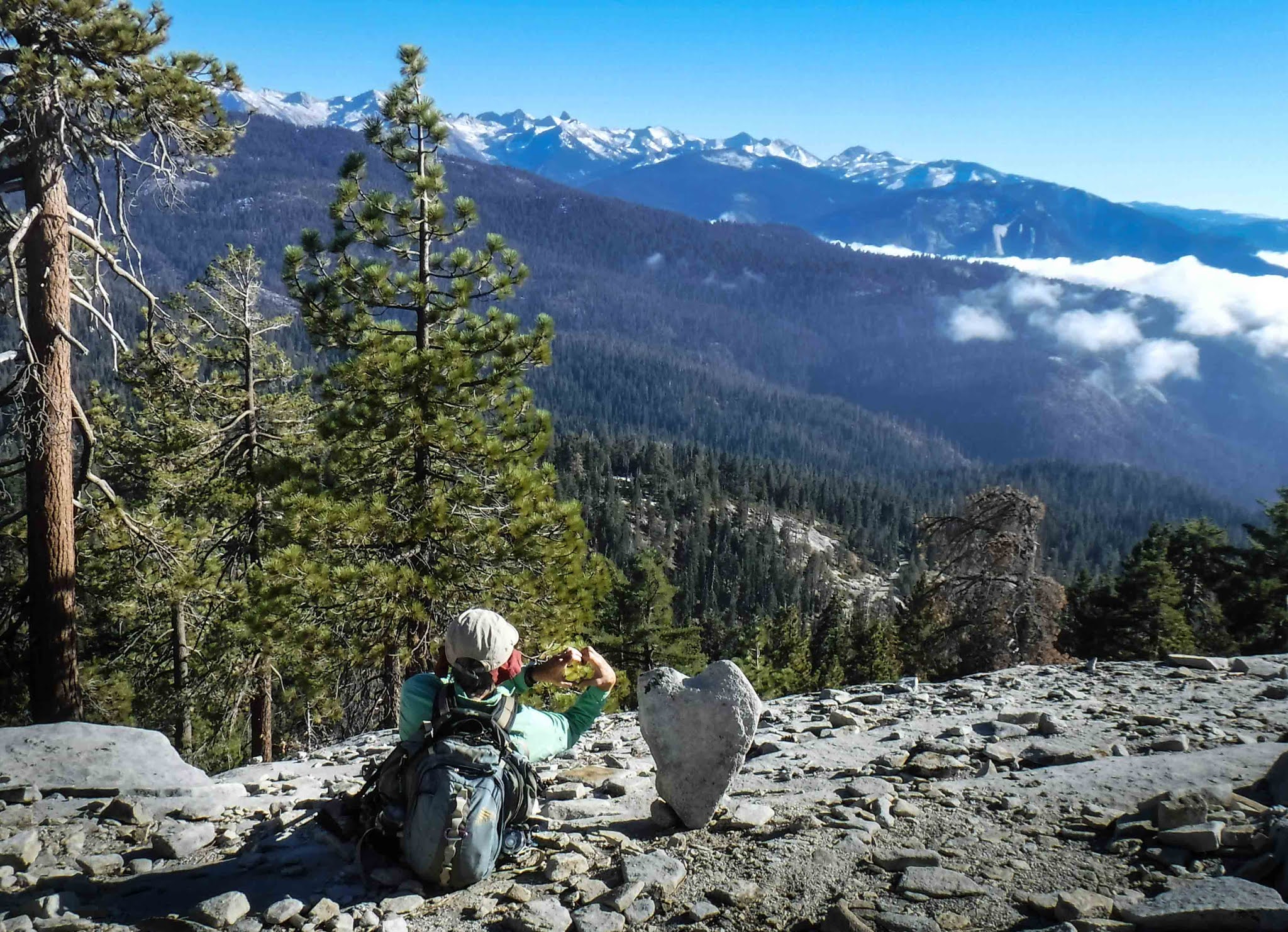
As we approached the summit, Felice noticed that someone had propped up a heart-shaped rock:


The dome was much quieter than it usually is -- no wind, no air traffic, no one else for miles around us.  The clouds were well below the summit, leaving the Great Western Divide sharp and clear:


On our way back to the trailer late that afternoon, we came upon a very small bear cub, maybe six months old, sitting in the middle of the road near Wilsonia.  He scampered off before we could take a photo.  But he looked exactly like a high-quality Teddy Bear, plump and fluffy.

Nov. 20:  Another cloudy day, perfect for Giant Forest.  We parked north of the Sherman Tree and then wandered off-trail along the headwaters of Sherman Creek, toward the Wolverton area.  Although the trees were not ancient (maybe "only" 500 years old?), the groves appeared to be very dense and healthy.

This is one of those "Where's Waldo?" shots.  Hint -- I'm in the bottom center of the picture:


Felice's red jacket makes it much easier to spot her:


This was taken with our radio camera trigger -- we wanted to test its range:


 Nov. 21:  The drive home was uneventful.  The trip was a success:  not an epic adventure, but a fun (and safe) escape from the strictures of the Covid era.  It was liberating to come back to an area we had visited so many times before:  we were not under any self-imposed pressure to see all of the sights, racing against time.  We just took our time and relaxed.


Tuesday, June 30, 2020

Tioga During the Pandemic: June 2020

After months of self-isolation, and after things began to open up, we decided to take a short "socially distant" boondocking trip to the Eastern Sierra.  Felice deftly snagged one of the scarce online reservations for a week of "day use" in Yosemite, so off we went!

June 17:  We were concerned that the exodus of RVs from Southern California would fill all of the available boondocking sites near Yosemite, but we had no problem finding a site.  (The access road was very rough, so we crawled up the hill at five miles an hour.)

We camped at about 7800 feet, in an area southwest of Mono Lake and the Mono Craters.  This is a shot taken that first evening from a forest road near our campsite -- the lake is just visible on the left side of the shot, and the craters are on the right:


June 18:  We drove up to Saddlebag Lake near Tioga Pass, knowing that the ferry was not running and that we would have to hike around the lake in order to get to the Twenty Lakes Basin.  Although it was worth the extra effort this time, we will never again begrudge the fare charged by the ferry operators.  The ferry saves a total of four hot and rocky miles.

It was eerie to be in the Lakes Basin with virtually nobody else around, a theme that would run throughout our week in the Tioga area.  The snow on the ground at ten thousand feet (the elevation of the basin) had largely melted, but there was still plenty of snow on the surrounding peaks.

We hiked off-trail, along the granite slabs, to Cascade Lake, which was just at the tree line.  The lake itself was nothing special, but North Peak (over 12,000 feet) towered above us:


Mt. Conness and its glacier (at about 12,500 feet) were just south of us:


June 19:  We drove into Yosemite, through the dreaded entrance kiosk.  The drive took only a half-hour, and the kiosk was a breeze -- just a few minutes' delay, much shorter than usual.  The computerized reservation system appeared to work perfectly -- well done, Rangers!  We predict that this will be the model for the future --  instead of admitting everyone who shows up (a recipe for overcrowding), the park service will limit the number of visitors each day.

We took the trail to Spillway Lake, starting at the Mono Pass trailhead.  The stream crossings were a little tricky -- slippery rocks and high water -- but not impossible.  The meadows were already green, even though the wildflowers had not yet arrived.  As at Saddlebag, it was very strange (and very pleasant) to be the only people in this immense "Sound of Music" landscape.  That's Parker Peak on the left and Kuna Peak on the right, both at about 13,000 feet:


We stopped for lunch along the outlet stream from Spillway Lake:


There were still a few big snowbanks overhanging the stream:


 June 20:  Before we left the campsite, I snapped another in a series of "little trailer in a big landscape" shots.  The photo does not show the silence and the sound of the wind in the trees and the cool breeze coming down the canyon every evening:


There were several really huge pine trees near the campsite -- we could not tell if these were Ponderosas or Jeffrey pines.  Next time we visit, we will come prepared with the information we need to tell the difference:


We drove up to the Bennettville trailhead, near Junction Campground.  (Some books call this the Mine Creek trail.)  The trail follows the creek past a string of lakes up into the high country.  This is Shell Lake, with Mt. Conness in the background:


We ended up at Spuller Lake, with White Mountain in the background:


Mt. Dana, at about 13,000 feet, was visible to the south:


June 21:  After three fairly effortful days, we decided to ratchet back a little.  We took the short May Lake trail, which was more crowded than the terrain on the eastern side of Yosemite.  The other hikers were very good about stepping aside to maintain the required distance and wearing masks when that was not possible, but it still felt odd to be worrying about infection while hiking.  Mt. Hoffman looms over the lake:


That afternoon, we took our bathing suits and water shoes to the Lyell Fork of the Tuolumne River:


The water (actually, the snowmelt) was very cold -- at most 50 degrees.  Felice bravely dunked (once), and I did my best to click the shutter at the right time to document the moment:


June 22:  Another photo of the campsite, still trying to capture the sense of isolation and privacy.  The trailer was in the shade all day, but the solar panel was in full sun, thanks to the extra-long cable.  This kept the trailer cool while fully charging the battery every day:


We drove up to to Tuolumne Meadows and took the Elizabeth Lake trail.  The trail is not too long but is pretty steep --a good workout.  Unicorn Peak is visible from the shore of the lake:


Although the official trail ends at the lake, there is a "use trail" that follows Unicorn Creek into the upper part of the drainage -- a very inviting green meadow leading up into the alpine terrain, with a cool breeze flowing downstream:


June 23:  The forecast was for hot weather (even at high altitude), so we wandered upstream along the Lyell Fork of the Tuolumne River.  As with so many other places we visited this week, a usually-crowded trail was virtually empty:


Veering off of the John Muir Trail, we followed a "use trail" upriver.  When we came to Rafferty Creek, a tributary, we could not find a safe place to cross -- the stream was a little too wide and a little too deep.  So we built a log "bridge."  Felice spotted a log with a pointed end that looked like a barracuda.  Using a rope, I dragged it into position:


We then guided the sharp end into a gap in the rocks so that it was anchored in place -- Felice's pole points to the gap:


After crossing our "bridge," we found a great swimming hole -- our boots enjoyed the view:


Just after we changed back into our hiking gear and headed back, it started to rain.  There was quite a bit of thunder, but we didn't get to see any lightning.  The sun came out briefly when we got to the bridge where the John Muir Trail crosses the river:


Back at the trailer, it was sprinkling lightly -- just enough to wet the sagebrush and release that wonderful spicy Western fragrance.

June 24:  We headed home.  The truck's blower motor (and thus the air conditioning) died just before we left.  We rode for seven hours across the Owens Valley and the Mojave Desert with the windows wide open, buffeted by hundred-plus degree gusts at 60 mph.  Too noisy for the radio, or podcasts, or Pandora.  The water in the water bottles was hot, and we could not stop for ice in the gas station mini-markets because we were not sure if the surfaces in the stores had been properly sanitized.  A very long day.

It is shocking how dependent on air conditioning we have become!  We tried to cope by mopping our shirts and heads with wet bandanas, just like the bad old days.  Felice took a photo of the temperature display in the rear view mirror.  It looks like I am having a lot of fun, doesn't it?


Monday, May 11, 2020

Rainbows

We love rainbows.  (Who doesn't?)  So we try to capture them, whenever we can.  These are some of our better rainbow shots.  Almost all of these are time exposures, which means that the camera sees much more color than we can.

September 2007:  This was taken in the high country of Yosemite, near Tuolumne Meadows.  This is "cloud iridescence," which is caused by the refraction of sunlight by ice crystals.  The sky looks black because I had to "stop down" the lens with a very tight f-stop, since I was shooting almost directly into the sun:


October 2008:  This is Berry Falls in Big Basin State Park, near Santa Cruz.  Just by luck, the rainbow was hanging in a patch of sun in front of a deeply shadowed rock wall:


July 30, 2010:  Narada Falls, Mt. Rainier:


October 14, 2010:  This was taken in the mist next to Yellowstone Falls.  You can actually see the yellow color of the stone that gave the river (and the falls and the park) their name:


October 23, 2010:  Arches National Park, near Turret Arch:


March 9, 2012:  This is a "moonbow."  The full moon was shining on Yosemite Falls.  We could see the moonbow with our own eyes, but the colors were very faint.  Notice the stars in the patch of sky at the top center of the shot:


September 22, 2012:  Takakkaw Falls, Yoho National Park, British Columbia.  "Takakkaw" means "wonderful" in Cree.  This shot does not show the full extent of the falls (more than a thousand feet high!) because I wanted to zoom in on the rainbow:


December 12, 2012:  Death Valley.  This is another iridescent ice cloud.  Once again the sky is black because I was shooting into the sun:


May 14, 2013:  We were boondocking in the Sequoia National Forest.  Our campsite overlooked Kings Canyon.  Just after a violent thunderstorm passed over us (conveniently during cocktail hour in a warm and dry trailer), the sun came out.  We stood on the edge of a cliff near the trailer, looking down at the end of the rainbow:


March 9, 2015:  This shot of Yosemite Falls looks as though it has been Photoshopped to add in the rainbow, but it's real.  Remember that in a time exposure, the colors have extra time to accumulate on the camera's sensor:


March 10, 2015:  This is Vernal Falls in Yosemite; we were on the aptly-named Mist Trail.  Often, there is so much mist on this trail that photography is difficult or impossible, but we got lucky -- the wind was blowing the mist away from us.  To get a sense of scale, Vernal is over 300 feet high. Note the small "double rainbow" or supernumerary in the lower left corner --  the usual color sequence is inverted because the light is being refracted twice:


This shot was taken a few minutes later -- I zoomed in on the boulder at the bottom of the falls.  I ordinarily would not include two shots of the same thing, but this detail shot shows how the craggy basalt has been rounded and sculpted by the water:


September 23, 2015:  This was taken along the Grottos Trail near Aspen, Colorado.  This rainbow was only about a foot long, but I liked the way the spray of water caught the light just above a shadowy overhang: 


November 11, 2015:  This was taken on the Little Baldy trail in Sequoia National Park, the day after a snowstorm.  The cold night-time temperatures had created hoarfrost crystals on the fresh snow, and the crystals refracted the sunlight.  We have never before or since seen this "rainbow sparkle" phenomenon:


December 17, 2015:  This was taken on the trail to Upper Yosemite Falls, at a point where the trail zigs closer to the falls.  It had snowed a couple of days before, and the weather was very cold.  During the night, the spray from the falls had frozen onto the rocks and would periodically crack away from the wall and plunge down into the canyon.  It sounded exactly like thunder from a nearby lightning strike:  Crack! Boom!

We got lucky with this picture -- the shadow of the nearby overhanging cliff had already fallen on the rock behind the rainbow, but it had not yet reached the falls themselves, so that the contrast between the bright rainbow and the dark rock was really sharp:


September 22, 2016:  We had just arrived at Great Basin National Park after a day of driving through northeastern Nevada in the rain.  The sun came out, giving us a big desert rainbow:


April 27, 2017:  This is another iridescent cloud, taken from Minaret Vista near Mammoth:


We're hoping to add more rainbows to our collection someday soon.