Sunday, March 16, 2014

Palomar Mountain: March, 2014


Tuesday, March 4:

We had a few free days, so we decided to head up to Palomar Mountain State Park, east of Oceanside.  On our way down Interstate 5, we stopped at a rest stop and saw an “MRAP” (mine-resistant armored protected vehicle) with this rather surprising license plate:


Although this looks like a joke, it wasn't – it turns out there was whole squadron of drivers getting trained.

When we got to the campground that afternoon, it was completely empty and silent, and it stayed that way for the next three days -- the nights were cold and dark, perfect for sleeping.  It was a very pretty campground, with lots of huge trees.  Even though our trailer is tiny, we had a hard time fitting into the "RV designated" campsite, and the apron was far from level – we had to pile up about 5 inches worth of blocks under one of the tires, just to compensate for the slope. 

Wednesday, March 5:

On a sunny and cool day, we hiked in a big loop around French Valley, the lower Doane Valley, and the upper Doane Valley – roughly 6 miles in total.  The French Valley area looked like the old West – high meadows (we were at roughly 5000 feet), dotted with oak and pine, with streambeds cut into the valley floor.  At the north end of French Valley, there was a spectacular grove of really ancient California Live Oak trees -- this one had recently fallen:


This tree was easily 12 feet in diameter -- my “wingspan” is over six feet:

At one point, we came across a flat granite outcropping,  punctuated with perfectly symmetrical conical holes full of rainwater – these were clearly "bedrock mortars."  The Indian women would sit near these holes and grind acorns into mush:


Over the next few days, we came across several other groupings of these pre-Columbian Cuisinarts.  These high valleys must have been very densely populated, especially in the summertime, when the Indians would come up to the mountains to escape the heat.  It was easy to envision groups of women clustered around these mortars, chatting in the shade, while the grindstones thumped in the sockets.  I couldn't figure out, however, why the Indians wouldn't just carry the whole acorns back to their villages in baskets and then grind them on raised stones, rather than squatting uncomfortably on the ground under the oak trees and then transporting the acorn flour back to the village.  There must be a good explanation, but I have been unable to find one.

In the moister areas of the Doane Valley, near the creek, there were groves of very large Western Red Cedars – they looked almost like Sequoias:


Thursday, March 6:

We took the Observatory Trail from the Observatory Campground up to (you guessed it) the Observatory.  For much of the way, the trail parallels the road, although the road is screened by trees.  On a busy weekend (with all of the high-performance motorcycles roaring up and down the road), this would be a noisy trail.  On a weekday, it was very peaceful.  At the upper end of the trail, the Forest Service had posted this phenomenally detailed and helpful map:

Everywhere we went in the Palomar area, we saw trees (both dead and alive) that had been peppered with holes drilled by the acorn woodpeckers, who had then stuffed the holes full of acorns:


We couldn't figure out whether the woodpeckers were actually eating the acorns or whether the woodpeckers would wait patiently until the acorns were infested with insects, at which point the woodpeckers would eat the insects.  (And when I got home, my Internet research was inconclusive, too.)

That night, we took a walk from the campground down to Doane Pond – the pond itself was covered in low fog, but the stars were very bright.  This is probably our last view of Orion until next winter:


This is a slightly different view of the pond, with a little less fog:


Friday, March 7:

We drove to the Julian area (about an hour away) to take the Cedar Creek Falls hike.  Although it wasn't much more than 5 miles round-trip, it was pretty steep.  It was an "upside down" hike, losing about 1100 feet on the way down and gaining it in the hot afternoon on the way back up, with no shade.  It is hard to imagine doing this hike on a hot summer day.

The falls themselves were very nice.  By Southern California standards, they were terrific – in the Pacific Northwest, this would be a below-average waterfall:


 There was a good-sized pool at the base of the waterfall.  The water was cold – probably about 60 degrees, at most.  We changed into our bathing suits, swam to the waterfall and back, and got out immediately.  Even though this was a weekday, it was pretty crowded – there were about 15 other people. Anyone interested in taking this hike must plan ahead and get a permit -- the Forest Service limits access to 75 people a day.  Since everyone probably shows up around lunchtime, it must get really crowded on a warm weekend day.

When we got back to the trailer late on Friday afternoon, the campground had suddenly gotten very busy (not surprisingly), and it was pretty noisy.

Saturday, March 8:  Before driving home, I walked out to revisit the grove of ancient oaks in French Valley – these are the biggest oak trees we have ever seen.  They have to be several hundred years old -- I am sure that the Indians were grinding acorns that fell from these same trees.  This was the most impressive grouping of oaks:


In this photo, notice my hiking poles (which are almost 5 feet long) on the left side of the trunk, just above my hat – this tree is close to 15 feet in diameter:


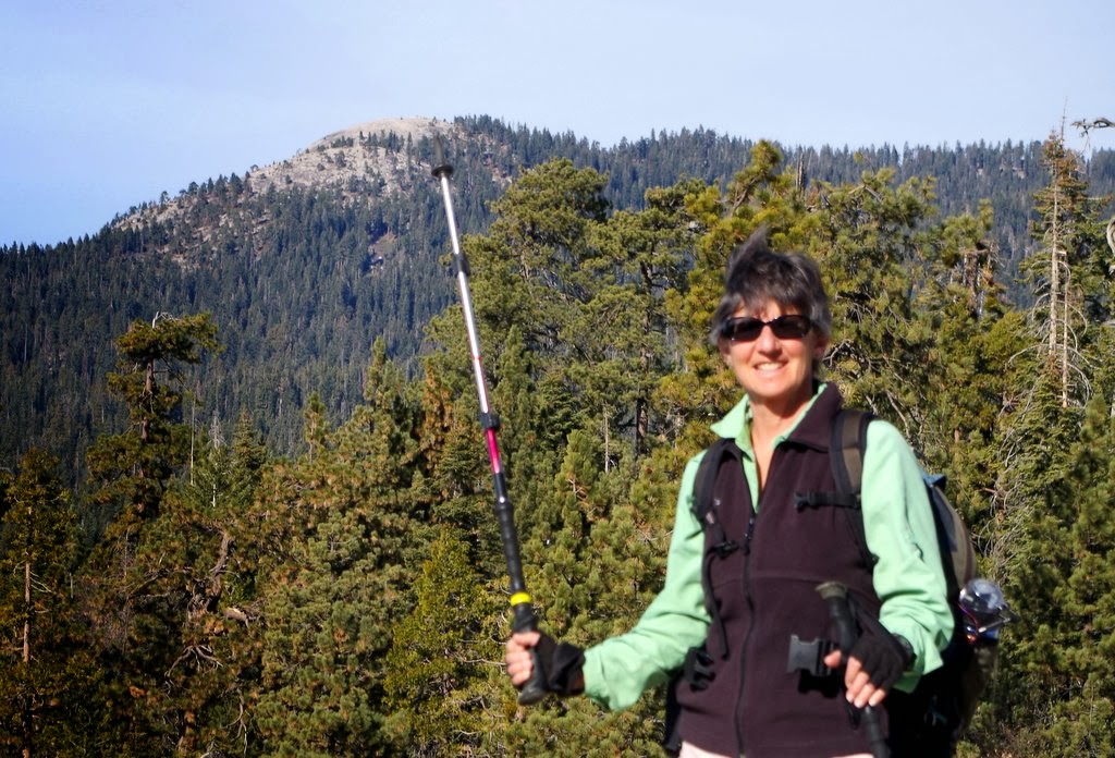
While I was shooting the trees, Felice jogged past and posed for this jaunty photo:


This is the obligatory "timer shot," in which I push the button and then scramble awkwardly to get into an ostentatiously relaxed position at the last second:


We left the campground around midday, and we were back home by midafternoon -- one of the shortest "commutes" ever!

Saturday, January 18, 2014

January 2014: Quick Trip to the Southern Sierra

We had a few open days, so (of course) we took off for three days of hiking in the Sierra.  None of the high-country boondocking was available, since all of the forest roads were closed; so we stayed at Potwisha Campground, near Three Rivers.  Much to our shock, the campground was about half full.  It wasn't crowded, but it wasn't empty.  The first evening (January 8), we took a walk on a trail near the campground and saw a ring-tail cat, which is apparently very rare, according to a ranger at the visitor center.  (It turns out that ring-tails aren't really cats -- they are more like sleek raccoons, which would be a great name for a rock band.)

January 9:  We hiked right out of the campground to Marble Falls.  The trail wasn't particularly steep, but it climbed very steadily for more than 3 miles.  The trail was above the river; we could hear it but not see it for most of the way.  There was a fair amount of shade.  In the summer, this trail would be terribly hot.  Along the trail, we passed through a small grove of California nutmeg, which looks like a fir tree with very sharp needles.  The nutmegs are fragrant -- but I am not sure they are edible.  It took us more than an hour and a half to get to the top of the lower falls:


Because the water level in the river was so low due to the drought, we were able to clamber through the boulder field toward the upper falls -- this picture makes it look more difficult than it was.  The white stuff on the rocks is not snow -- it is calcite deposited on the boulders:


Near the upper falls, we climbed into a deep overhang carved out of the marble and calcite strata – the marble was much more resistant than the calcite or limestone, creating a "curtain" effect:


The sheets of calcite, which look like sun-dappled snow but have a texture like sandpaper, extended into the “plunge pond” below the upper falls:


This shot of the falls isn’t particularly dramatic because the water is so low, but we took it for the sake of comparison. We are hoping someday to get back to this spot in higher water:


(Warning: you are about to encounter several paragraphs of amateurish geological speculation. You might want to skip ahead if rocks don’t excite you.  But if you like solving puzzles, read on.)

As you can see in the preceding photos (especially of the cave-like overhang), we noticed that all of the strata were tilted 90° from the horizontal.   We were puzzled by this anomaly – in the very highest part of the Sierra, the remnant metamorphic layers (sometimes called the “roof rock”) are essentially horizontal. By contrast, why were the layers vertically oriented throughout the canyon at this much lower elevation, and why didn't this particular area of metamorphic rock get lifted up by the rising "plutons" (the huge hot bubbles of basalt) that created the mountain range?  And where had the marble come from, anyway?

It took us a while to figure it out by working backwards, but this is our best guess:  in the beginning, ordinary sedimentary rock formed in a shallow ocean, essentially where the San Joaquin Valley is now.  We figured that it had to be shallow water, for several different reasons.  First, we could see that the metamorphic rock (i.e., the compressed sedimentary rock) contained a lot of river cobble inclusions, which must have come out of creeks and rivers.  Those cobbles would have settled in shallow water.  Second, the fact that the rock was originally limestone meant that it must have been formed by the calcium-laden shells of tiny marine animals, such as diatoms.  Those creatures usually grow in shallow, sunny water.

Anyway, after the sedimentary layers were established, sheer heat and pressure (due to the weight of the overlying rock) would have created the marble from the limestone and the sandstone.  We could tell that the marble had not been deformed – the layers were fairly evenly parallel, rather than wavy.

Next, the horizontal layers of marble were pushed up sideways by the rising basalt of the Sierra. Although the marble at the higher elevations was pushed straight up from below, this marble (which was on the western side of the upwelling that created the mountain range) remained essentially in place but was reoriented and rotated by the upthrust.  I don’t know if that’s right, but it sounded plausible to us.

(End of geology sermon.)

January 10:

We decided to see whether we could do some hiking back in the Mineral King area, which is ordinarily unreachable during the winter. The Ranger provided us with the combination to a lock securing the gate across the road at the border to the national park. The road is as difficult as everyone says it is: very twisty and slow and narrow. Not surprisingly, however, since the road was closed, we did not see one other car (or any other people) for the entire day.

After more than an hour of driving, we we came to another locked gate about 2 miles away from the trailhead in the Atwell Grove Campground, so we had to hike to the trailhead on the roadway (which wasn’t unpleasant at all).  The first part of the trail descended gently to the bridge across the river.  The trail was dry, but it got very icy near the bridge; we eventually had to slip on our micro-spikes.  There were young sequoias growing along the creek:


It was fun (and maybe a little spooky) to have the entire forest completely to ourselves -- I am fairly sure that there was absolutely no one within 20 miles of us in any direction.  We hiked through the southern portion of the Atwell Grove, stopping for the obligatory "huge tree and small person" shots whenever we could get a long shot of an entire sequoia (which is very seldom). Felice is in the patch of sunlight at the base of the tree:


All told, including the walk along the roadway, we hiked for about 9 miles, with probably a thousand feet of elevation gain.  Not a big deal, but pleasantly tiring.  And having our own private forest gave us a spurious sense of adventure.

January 11:

We headed up to the Giant Forest area and first took a short hike to Sunset Rock, a granite dome.  We could see an old friend, Little Baldy, off to the West  –  the tip of Felice's pole is pointing right at it:


The next time we hike up to the top of Little Baldy, we will try to locate Sunset Rock off to the southeast.  Sunset Rock would be great for snowshoeing, if only there were some snow.  On our way back to Giant Forest, we cut over to the Beetle Rock trail, which would also be great for snowshoeing.  After lunch, we drove over to the Congress Grove area – this is the McKinley Tree, with Felice at the base:


This is a particularly impressive root ball, especially when you consider that this is just the top half of the root ball -- note the trees growing out of the top:


Along the trail, we found two trees growing closely together, which Felice always loves:


Late that evening, the moonlight was very bright.  This is something of a trick shot – at first glance, it looks like noon, but it's not, as you can see from the stars over the mountains.  The trick is a long exposure at a high ISO rating:


Wednesday, November 06, 2013

Snow Camping in the Sequoias: November, 2013

(If you want to skip the text and see a slide show instead, just click on a picture and use the arrow keys.  Hit "escape" if you want to get back to the text.) 

We had a few days available, so (naturally) we decided to head for the mountains.  As we were getting ready to go, we were tracking a weak snowstorm that was passing through the Sierra.  We knew that the roads might close and that we might have to make alternate plans; if we couldn’t get to the Sequoias at all, we would go to Yosemite Valley.  Not such a terrible fallback plan!

October 30:  As we drove north on Highway 99, we called the Sequoia National Forest office and they told us that although the roads were technically still open, the forest had received about 6 inches of snow.  The Ranger that we talked to described the forest roads as “iffy,” even though the main highway (between Kings Canyon and Sequoia) was still open.  We decided to take a chance – if the Sequoia National Forest roads were impassable, we would just have to stay in Azalea Campground in Grant Grove (Kings Canyon National Park), rather than boondocking out in the national forest.  Again, not a bad "Plan B."  (“Boondocking” is otherwise known as “dispersed camping.”  The forest service permits camping on most forest roads, but campers have to be completely self-contained and to provide their own water.)

When we got to the national forest south of Grant Grove, we could see that the forest roads were indeed pretty snowy and utterly untracked.  Were they passable at all?  And could we tow the trailer through the snow?

There was only one way to find out.  We unhitched the trailer and left it at a pullout, and we went exploring with the truck, to see what was available (and what we could handle with the trailer).  Yes, we were concerned about getting stuck in the snow.  But we felt that we were reasonably well prepared: we have fairly serious all-terrain tires and four-wheel-drive and high clearance.  We also carry tire chains for both the truck and the trailer, as well as a winch, tow straps, snatch block, shovels, and so forth.    To someone from a snowy climate, our concern and uncertainty would probably be laughable.  But we are “flatlanders” from sunny Southern California, and I had never driven in 6 inches of untracked fresh snow, with no snow plow in sight, and no one else around.

When we came to one of the less-hilly forest roads, it was time for a trial run.  I pulled the truck off the plowed highway and aimed it at the snow bank that had been piled up by the snow plow.   I put the truck in “four-wheel-drive low” and drove slowly ahead.  The truck crunched right through the snow bank and then continued down the untracked road, into the forest.  Some of the snow drifts were almost a foot deep, but it was no problem.  The truck didn’t slip at all, and I didn’t have to push on the accelerator.  We just rumbled along, slowly and carefully.  The "road" was surprisingly smooth.

With a little more confidence, we scouted a couple of possible boondocking sites on a couple of different roads.  Both sites were acceptable; but both of them were surrounded by high trees, with no views of the nearby snowy mountains.  Since we were feeling better about driving through the fresh snow on the forest roads, Felice suggested a more remote area, with better views of the mountains. We were pleased to discover that it was no problem to drive the truck through the snow on some fairly hilly terrain.  We decided that we could safely tow the trailer into the backcountry, especially since this trailer has extra high clearance.

So that’s what we did. We hitched up and slowly pulled the trailer over the hills and then off the forest road, through the snow, and down onto a broad granite slab.  The slab, which was fully exposed to the sun, was less snowy than the road or the surrounding forest:


As far as we could tell, there were no other people within many miles of our campsite.  It was a gloriously sunny and cool day when we arrived; but soon thereafter, it got pretty warm, and the snow started to melt.  Even though we were on a granite slab, there was enough decomposed granite on top of the slab to hold a lot of meltwater, creating a messy slurry.  We dug a shallow trench through the gravel to drain our campsite, and it worked very well:


(In case you’re wondering, we filled in the trench and smoothed out the gravel when we left our campsite a few days later.)  In that picture, you can see the bright orange “Legos” underneath the right wheel of the trailer.  We had to elevate the right side of the trailer in order to level it, because the slab slanted so steeply.  Also, as a result of the slant, the distance from the ground to the bottom step of the trailer was about two feet, so that’s why we put the little step stool next to the front door of the trailer.  In an effort to avoid the muddy gravel, we spread out a tarp as a staging area for our equipment.  After we got all of our stuff set up (which always takes us quite a while), we had time to admire the view of the Great Western Divide to the south:


After dinner, we took a walk, but the roadway was pretty icy because the slush had frozen.  The Milky Way was fairly prominent, although there was some light pollution from the San Joaquin Valley.  This picture was taken at an ISO of 3200 and an exposure time of 20 seconds.  I illuminated the trailer very briefly with an old incandescent flashlight, hoping to avoid the blue cast of the LED flashlight, and it worked pretty well:


In this shot, the snowy Great Western Divide is in the far southern background:


That evening, inside the trailer, we thought we would have to run the heater, since it was in the high 20s outside.  (We almost always run the heater for a few minutes before dinner, at shower time, but rarely run it in the late evening -- it is noisy and it uses a lot of electricity.)  As it turned out, we did not need any heat.  The trailer stayed in the low 50s during the evening (hurrah for thick insulation!), and we were very comfortable with warm clothing and lap blankets.  Felice tried out her latest innovation, an old-fashioned pink hot water bottle tucked under her blanket, and it worked very well.  And at night, even though the inside of the trailer got down to the low 40s, we were plenty warm, thanks to our down comforter.  So although it is true that we were technically "snow camping" (since there was some snow on the ground), this was far from roughing it.  "Smoothing it" would be more accurate.

One of the best parts of boondocking is sleeping like a log in the cold, dark, silent trailer.  On an ordinary night at home, we average about 7 hours of sleep.  On this trip, we got at least 8 hours every night, and one night we slept for 9 hours.

October 31:  The morning was sharply clear and cold.  We walked over to a nearby ridge to look at the view.  During the storm, the snow on the ridge had been whipped up into waves:


Seen from a few inches away, the texture of the snow was very fluffy and crystalline:


We couldn’t resist this shot of our little trailer, sitting forlornly across the gully:


We headed down the highway to Little Baldy, an 8000 foot dome with 360° views of the Sierra.  The Little Baldy trail was completely unmarked – we were the first people to hike it since the storm.  The footing was not too bad – the snow was dry and fluffy (at least in the morning), and it was not too deep:


The oak trees were changing color, and the leaves were scattered on the snow:


As we neared the peak, we discovered that a bear had very recently walked across the trail – this is clearly the bear’s left foot, although I’m not sure if it’s the front or the rear foot.  Note the crisp imprint of the knuckle of the small toe on the left side of the picture:


Although we stayed on high alert, we did not see any bears.  Up at the summit, at just over 8000 feet, the snowy Great Western Divide was etched sharply against the sky:


This is a quick panorama from the summit:


That afternoon, on the way back to the trailer, we stopped off at Lost Grove – Felice is at the bottom center of this picture:


Across the creek, there was a huge downed tree streaked with snow:


We went over to the east side of the grove and climbed up the steep hill, traversing across the snow:


November 1:  We took the Alta trail, which starts in the Wolverton area and climbs to Panther Gap. This trail got us a lot closer to the backcountry -- these shots are of the Kaweah Peaks Ridge area from Mehrten Meadow:


The trail up to Panther Gap was snowy (and very slushy in the late afternoon), but the Alta trail along the cliff was clear and dry because of the southern exposure.  If it had been snowy, the narrow trail would have been too dangerous.  That's Panther Peak on the left, and that's Felice crossing the avalanche chute on the right:


At one point, we passed a couple of hollow logs – we could see the branches sticking in toward the middle of the log.  Apparently, the center of the tree rots more quickly than the knots:


When we got back to our campsite in the late afternoon, our little “rig” was posed against the backdrop of the mountains:


Note the green water cans next to the trailer – when we are boondocking, we have to bring extra water.  It’s a lot of work to fill the cans and then to lift them up and pour them into the trailer’s fill tube; boondocking involves a great deal of physical labor, but it is well worth the effort.

November 2:  We decided to hike to Muir Grove.  Yes, it’s true that we do this hike fairly frequently, but with good reason: this is a premier grove, with enormous trees in a park-like setting, far from the highway.  The hike was longer than usual because Dorst Campground was closed; but that meant that we had the trail all to ourselves.  Once again, we were the first people to hike on this trail since the snow had fallen.

However, we were not the first creatures to use this trail since the snowstorm.  We quickly discovered that the bears and the deer use this trail as an “animal highway” through the forest.  (A Ranger once told us that the animals are not stupid – rather than struggling through the underbrush, they use man-made trails when they really need to make tracks, so to speak.)  And speaking of tracks, in this shot all of the footprints on the trail in front of Felice were all made by bears:


In addition to footprints, the bears left other subtle signs:


Notice all of the partially-digested berries – although I did not get too close, I am pretty sure that these are manzanita berries.  There were lots of manzanita bushes along the trail, loaded with reddish berries.  I tried to eat a few – they were waxy, bitter, tasteless, and full of seeds.  The bears must be pretty desperate to eat manzanita.

Along the trail, the fresh snow coated the rocks like whipped cream over chocolate chips:


Unlike our last trip to Muir Grove in the snow (when the wet snow clumped up under our snowshoes), the snow was not too deep and not too sticky, making for better footing.  When we arrived at Muir Grove, the reddish bark of the trees was illuminated by the slanting afternoon light.  

This picture is an “HDR” (“high dynamic range”) shot of the circle of giant sequoias at the entrance to the grove -- these trees are about 300 feet high.  In HDR, the camera takes three pictures in rapid succession, at differing light values, and then combines the images electronically.  The advantage is that even though the sky is bright, the colors and textures of the shadowy tree trunks are still visible.  In an ordinary non-HDR shot, the trunks would have been much darker:


It seems to me that the HDR technique produces a much more “true to life” image.  The only downside is that the camera has to be mounted on a tripod – otherwise, the slight movement of the hand-held camera means that the three images will be slightly blurred, except if a very fast lens speed is used.  Using the tripod for an overhead shot requires some contortions:


Here is a very short video of the same cluster of trees:


After lunch, we hiked into the western part of the grove.  We passed a tree that had symmetrical openings in the base of the trunk:


We found another odd tree that we had never noticed before – it had been hit by lightning, and the core of the tree had completely burned.  But the top of the tree was still living.  This is a view straight up the center of the tree:


Finally, we visited Felice’s favorite trees, the “husband-and-wife” pair, in a remote portion of the grove:


For the sake of comparison, this picture shows the full height and scale: